Applications of GIS

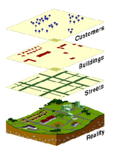
Resource and geological exploration Location of engineering structures such as bridges, tunnels or dams can do by studying the satellite imageries. The siting of storage reservoirs can be studied. The…

Application of GPS

Application to surveying Establishment of high precision zero order geodetic national survey control network of GPS station connecting Remote Island to mainland geodetic control networks. Survey control for topographical and…

What is a total station?

When digital theodolite is fitted with electronic distance measuring units so that the distances and angles can be measured simultaneously they become total station these are operated using a multi-faction…