Application to surveying
- Establishment of high precision zero order geodetic national survey control network of GPS station connecting Remote Island to mainland geodetic control networks.
- Survey control for topographical and cadastral surveys.
- Ground control for photogrammetric control survey and mapping.
Application of geology
- Geophysical positioning, mineral exploration, and mining.
- Determination of a precise geoid using GPS data.
- Earthquake monitoring.
Application of navigation
- Off share positioning – shipping, offshore platforms, fishing boat etc.
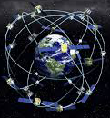
- Spacecraft tracking – vector separation between GPS satellites and other satellites can be monitored by GPS.
- General aircraft navigation, the approach of runways, navigation/posting in a remote area like a desert, dense jungles, shaded area of microwave, precise sea navigation, approach to harbors etc.
Application to military
- Military, improved weapon delivery accuracies i.e. for missiles etc. for ranging in artillery, navigation for army, navy, airfare thus affecting ultimate.
Application to water resources and environment management
- GPS technology is being used extensively in the management of earth rapidly depleting natural resources and degrading environment.
- Design and planning of dams, spillways, hydroelectric power project, canals etc, is greatly simplified using GPS- based aids.
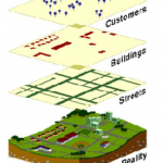
- Natural disaster management and mitigation with GPS – GIS-based system.
- Locating hazardous wastes, using GPS based location system.
Vehicle guidance system.
GPS can be used in the guidance of robots and other machines.