The most relevant maps in the field of civil engineering are as follows.
Topographic maps
- Topographic maps show a 3-dimensional world in 2 dimensions by contour lines.
- Engineers use topographic maps when they are planning roads, buildings, or another human – made the structure. Normally, these are drawn to a scale of 1cm = 2.5 km to 1cm = 0.25km
Location map
- This map shows boundary locations of the site with respect to neighborhood parks. The map is drawn to a scale of 1: 2500 to 1: 500
Cadastral maps
- This map defines the extent, value, and ownership of land for taxation purposes.
- It provides a cartographic record of officials and sometimes private land surveys and subdivisions.
- It facilitates the administration and transfer of land it records land ownership also assists in the valuation and taxation of land. These maps are drawn to a scale 1:1000, 1:5000 and 1:2500.
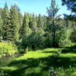
Forest map
- These are used to show data on national parks forest classes, boundaries, and density of vegetation.
- Satellite update vegetation information like a dense and open forest, suburbs, mangroves etc. can be provided, these are normally drawn to a scale range at 1:50,000 to 1:250,000 scale.
Geological maps
- A geological map is a map of different type of rocks that are on the surface of the earth. by mapping different rock types, geological can determine the relationship between different rock formation.
- which can be used to find material resource oil and gravel deposit also, one should show what type of rock or support strata you have for your structure, to avoid any mishap such as differential settlement, tilt or total collapse of the structure.
Environmental maps
- These types of maps that look at human activity in urban and metropolitan areas and the environment in which we all live.
- Meteorological maps that show climate, weather and wind are types of environmental maps.
- Metropolitan, oceanographers, geographers city planners, and many other professions also depend greatly on these maps to record and forecast their specific field.
Biogeographic maps
- A scientist involved in the study of animals, plants and other living organisms use maps to illustrate where these groups live or migrate.
- It is important to many zoological to know where the organisms that they study life and where they study life and where they move to.
- People who moniker endangered species need to know if the range of migration has become large or smaller through time.