Geographic information system [GIS] is computer software which gives information of any discipline. It can be defined as an organized collection of computer hardware, software, geographic data and personally designed to efficiently capture, store, update, manipulate, analysis, model and display all forms of spatially referenced data for solving complex planning and management problem.

In recent years the demand for storage analysis and display of complex and voluminous recourse data has led to the computers for data handling and the creation of sophisticated information system like GIS. Surveyors and engineers understand the impotence of geographic data. It has become an important tool for decision- makers.
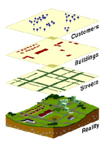
A GIS can combine geographic and another type of data to generate maps and reports, enabling users to collect, manage and interpret location-based information in planned and systematic from the database, needs continues operation, we can retrieve land users road networks, services like sewers, telephone line etc. Natural recourse, demographic features, amenities like school, college, hospital, etc. to any required scale.

